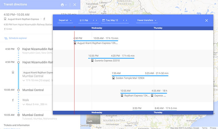
To help you out with the public transportation in your city, Google India has added massive database of Indian Railways schedules along with updated bus and metro information for eight Indian cities on Google Map transit.
Google India has added the massive database of 12,000 trains from Indian Railways schedules to its Google Maps transit feature. Those who don’t know about Google Transit, it’s a feature you see on Google Maps that helps you to check public transport like train, bus and metro in an area. Today’s update will allow you to get all relevant information of around 12,000 trains running around India on Google Maps. You will also get door-to-door directions to your destination using the public transport options available. You can also see the entire train route, where it’s stopping next and the train running time.

To get started with transit, simply type your destination where you need to go into Google Maps, click on the ‘Get Directions’ icon and then select the ‘Public Transit’ icon on top to find which train, metro or bus options are available. When you have selected the transit path, Google Maps will offer door-to-door directions to your destination using the public transport options available and walking directions to and from transit points.
In addition to the Indian railways schedules, Google India has also added metro and bus information for eight Indian cities including Bengaluru, Chennai, Ahmedabad, Gurgaon, Hyderabad, Kolkata, Mumbai, New Delhi and Pune to Google Maps transit.
So have you planned your travel using Google Maps Transit? Let us know the experience.


