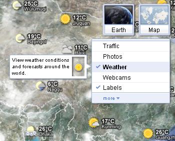
Google Maps just got even more useful: Starting Thursday, the search giant added a “weather layer” to Maps that you can use to check out current temperatures and forecasts around the world.
To add the weather layer when you’re looking at a Google Map, just “hover over the widget in the upper right corner …. (and) select the weather layer from the list of options,” said Jonah Jones, Google user experience designer on the company’s blog. “When zoomed out, you’ll see a map with current weather conditions from U.S. Naval Research Lab. And, if you look closely, you can also tell if it’s day or night around the world by sun and moon icons.”
“Whether you’re organizing a trip overseas or a picnic at a local park, knowing the weather forecast is a crucial part of the planning process,” Google user experience designer Jonah Jones wrote in a blog post. “Today we’re adding a weather layer on Google Maps that displays current temps and conditions around the globe, and will hopefully make travel and activity planning easier.”

Check out the new weather layer here.


